Day Three: Sedalia to Pilot Grove
Maybe I should name this one Bataan Death March II. This was, by far, the most difficult day to date. The distance I covered on this leg was something on the order of 24 miles. Make that 24 miles on two badly blistered, aching feet with a 50-plus pound backpack and with probably 15 or so of the miles on a slight, but detectable uphill slope. But on to the narrative...
Since I began planning this trip, I have always been a little intimidated by this section. It is long, with little water, and really no way to divide it into a more manageable distance. I knew that it was going to be tough, but I guess my thoughts were that if I got through this one, the rest of the trip would be relatively easy.
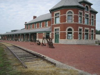 After spending a nice night at the Hotel Bothwell, I started on the trip east. This part of the trail goes along the streets in the eastern section of Sedalia. It is somewhat of a run-down section of town, but hey, that's OK by me. After walking about six blocks, you come across the Katy Depot. It was built about 100 years ago, and has been restored. It is really nice looking.
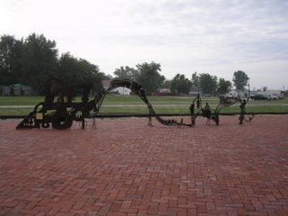
In this picture, you see a steel sculpture of a train going over hills. Little did I know that this was an accurate map of the next chuck of the trail. It especially felt like I had been walking barefoot on sharp steel before the day was over. But I protest too much!
The first part of the trail out of Sedalia is fairly uneventful. My main occupation was stopping every few miles to adjust my shoes and apply more moleskin to the ouchies!
After the first 8 miles or so, I did come across a fairly co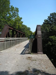 ol bridge. If it seems by looking at this picture that the trail seems to be tilting upwards a little, guess what? It is! It was right in this area that I had to do a gut check, and just decide that my feet were going to hurt, but I was just going to have to get through this section of the trail. In the Katy Trail Guidebook, it says that cyclist sometimes get psyched out on this part of the trail, thinking the whole 225 miles is going to be one long grade. I can understand those feelings.
After 11.7 miles, you come to Clifton City. Up until this stop,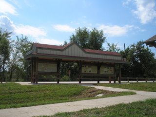 every one of the trailheads had water available. Well, not Clifton City. It was a nice trailhead physically, with shade, picnic tables, etc., and the brochures say that water is available. Not so! The aforementioned guidebook said that water was scarce in this section. I took the matter to heart, and was carrying six liters of water -- something like 13 pounds or so on my back. This sure didn't do my aching feet much of a favor. I really do believe that in 2006, there should not be a trailhead on this whole route that does not have water. I understand Clifton City in on well water, but guess what, DNR? Dig a damn well and provide the water! Better yet, there are plenty of overlapping rural water districts around. Figure this one out. This is a safety issue. I guess this is not quite as big an issue for cyclists, but 24 plus miles between reliable water sources is too long.
Ok, now I am stepping back off my soapbox. I sat barefooted at the picnic table in Clifton City and ate my MRE lunch before heading on to Pilot Grove. Basically, my feet were aching so much, and the grade was so continuous, that I pretty much just kept my head down and just pounded out the miles.
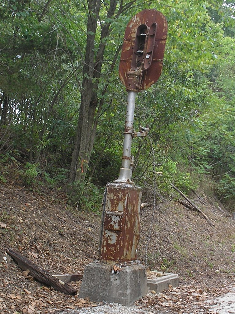
I did take note of a few of the sights on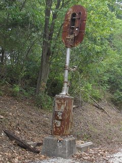 this section of the trail. This is advertised as the only intact railroad signal still on the trail. It is a little worse for the wear. I wish I had felt a little better along this section, I would have liked to study this a little more than I did. Well, maybe if I take up cycling, I will spend a little more time gazing upon this relic.
I do feel a little bad that I didn't take in a few more of the highlights on this section, but frankly, there weren't that many and I had a lot of distance to cover. I will say that there is some pretty scenery as you climb up to the plateau that Pilot Grove sits on.
By this time in the walk, I was tired and sore, but wanted to get off the trail as soon as I could. Normally, I try to stop every three miles or so for a breather. Just to get this leg done, however, I walked basically non-stop for the last 8 miles. When it got down to the last couple, you just focus on picking up your feet and putting them back down. I have to admit, that the thought of hitch-hiking that last few miles into Pilot Grove was tempting. I didn't succumb to that, but it sure sounded like a good idea at every road crossing.
With about a mile left to go, I caught sight of the grain elevator at Pilot Grove. I started laughing out loud. I was pretty much physically and mentally whipped.
My plan was to camp in Pilot Grove that night, and had contacted city hall for permission. When I got to the park where I was going to sleep, I called Theresa to let her know I had made it. As I started to tell her about my feet, she asked me if I wanted her to come get me so I could sleep at home that night. At first, I thought "No, this is not what I planned" but as my feet continued to throb, I thought better of it. In less than an hour, I was on my way home, and feeling much better.
Since I began planning this trip, I have always been a little intimidated by this section. It is long, with little water, and really no way to divide it into a more manageable distance. I knew that it was going to be tough, but I guess my thoughts were that if I got through this one, the rest of the trip would be relatively easy.
After spending a nice night at the Hotel Bothwell, I started on the trip east. This part of the trail goes along the streets in the eastern section of Sedalia. It is somewhat of a run-down section of town, but hey, that's OK by me. After walking about six blocks, you come across the Katy Depot. It was built about 100 years ago, and has been restored. It is really nice looking.
In this picture, you see a steel sculpture of a train going over hills. Little did I know that this was an accurate map of the next chuck of the trail. It especially felt like I had been walking barefoot on sharp steel before the day was over. But I protest too much!
The first part of the trail out of Sedalia is fairly uneventful. My main occupation was stopping every few miles to adjust my shoes and apply more moleskin to the ouchies!
After the first 8 miles or so, I did come across a fairly co
 ol bridge. If it seems by looking at this picture that the trail seems to be tilting upwards a little, guess what? It is! It was right in this area that I had to do a gut check, and just decide that my feet were going to hurt, but I was just going to have to get through this section of the trail. In the Katy Trail Guidebook, it says that cyclist sometimes get psyched out on this part of the trail, thinking the whole 225 miles is going to be one long grade. I can understand those feelings.
After 11.7 miles, you come to Clifton City. Up until this stop,
 every one of the trailheads had water available. Well, not Clifton City. It was a nice trailhead physically, with shade, picnic tables, etc., and the brochures say that water is available. Not so! The aforementioned guidebook said that water was scarce in this section. I took the matter to heart, and was carrying six liters of water -- something like 13 pounds or so on my back. This sure didn't do my aching feet much of a favor. I really do believe that in 2006, there should not be a trailhead on this whole route that does not have water. I understand Clifton City in on well water, but guess what, DNR? Dig a damn well and provide the water! Better yet, there are plenty of overlapping rural water districts around. Figure this one out. This is a safety issue. I guess this is not quite as big an issue for cyclists, but 24 plus miles between reliable water sources is too long.
Ok, now I am stepping back off my soapbox. I sat barefooted at the picnic table in Clifton City and ate my MRE lunch before heading on to Pilot Grove. Basically, my feet were aching so much, and the grade was so continuous, that I pretty much just kept my head down and just pounded out the miles.
I did take note of a few of the sights on
 this section of the trail. This is advertised as the only intact railroad signal still on the trail. It is a little worse for the wear. I wish I had felt a little better along this section, I would have liked to study this a little more than I did. Well, maybe if I take up cycling, I will spend a little more time gazing upon this relic.
I do feel a little bad that I didn't take in a few more of the highlights on this section, but frankly, there weren't that many and I had a lot of distance to cover. I will say that there is some pretty scenery as you climb up to the plateau that Pilot Grove sits on.
By this time in the walk, I was tired and sore, but wanted to get off the trail as soon as I could. Normally, I try to stop every three miles or so for a breather. Just to get this leg done, however, I walked basically non-stop for the last 8 miles. When it got down to the last couple, you just focus on picking up your feet and putting them back down. I have to admit, that the thought of hitch-hiking that last few miles into Pilot Grove was tempting. I didn't succumb to that, but it sure sounded like a good idea at every road crossing.
With about a mile left to go, I caught sight of the grain elevator at Pilot Grove. I started laughing out loud. I was pretty much physically and mentally whipped.
My plan was to camp in Pilot Grove that night, and had contacted city hall for permission. When I got to the park where I was going to sleep, I called Theresa to let her know I had made it. As I started to tell her about my feet, she asked me if I wanted her to come get me so I could sleep at home that night. At first, I thought "No, this is not what I planned" but as my feet continued to throb, I thought better of it. In less than an hour, I was on my way home, and feeling much better.
posted by Greg at 10:11 PM
![]()

0 Comments:
Post a Comment
<< Home